Total elevation gain from the Damfino Lakes Trail 625 northwest trailhead on FS 31 via the northwest ridge trail of Cowap Pk to the activation location just northwest of Cowap Pk summit: 413 m (1356 feet). Approximate trail distance each way: 3.4 km (2.1 miles). The activation is a reasonable one-day trip, and, except for one spot just northwest of the actual summit, a problem-free climb. The activation zone northeast of the summit is easily accessible, and a great family destination.
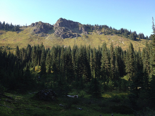
Cowap Pk W7W/WH-153 [i] in the Mount Baker-Snoqualmie National Forest is not well known. FS 31, the Canyon Creek Road, [ii] was closed for years due to a landslide, so the only practical way to Cowap Pk was via the West High Divide Trail 630 [iii] over Excelsior Pass [iv] and down the Damfino Lakes Trail 625, [v] which connects to the Boundary Way Trail 688 [vi] via a short link on the Canyon Ridge Trail 689.[vii]
Since FS 31 is now open, Todd Thompsen W7TAO and Bruce Prior N7RR decided to activate Cowap Pk for Summits On The Air (SOTA).[viii] We met at the Ranger Station in Glacier on the morning of 2014-09-16. Todd parked his car at a boat launching site, and we continued together in Bruce's Jeep Wrangler to the Damfino Lakes Trail 625 northwest trailhead,[ix] where a pit toilet is available. We found FS 31 is in good condition, so a 4-wheel-drive vehicle is not necessary. There were no other vehicles in the parking lot and we started a new page on the hiker register.
The sky was blue and the temperature mild. Although Todd broke lots of spider webs as he led the hike, insects were scarce. It was a great day for a SOTA activation. We hiked a short distance east on Trail 625 to the Canyon Ridge Trail 689, where we turned northwest. When we hit Boundary Way Trail 688, we turned northeast. We were soon rewarded with a fine view of Cowap Pk.
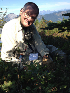
The Southwest Ridge of Cowap Pk looked formidable, so we continued northeast along the trail south of the long Cowap Pk ridge. We eyed the spot on the map [x] where the trail reached the northeast ridge, [xi] planning to ascend the summit from there. As it turned, we came to an open area where we decided to climb directly up to the ridge. [xii] We needn't have bothered. Bruce got entangled in underbrush and had to traverse to find an upward route. Once on the ridge, we found a clear trail which led almost to the summit. We should have continued until the Boundary Way Trail reached the ridge. On the way up the ridge, Bruce pocketed some rocks, larger than fist-sized, for launching antennas over tree branches. Bruce used a scaffold knot to secure the throwing line to the rocks.[xiii] The trail to the summit led to a knife-edge section with an exposed class 3 section. A class 5 rope belay would have been entirely in order for crossing that section. We had left our helmets in the Jeep. Bruce declined to venture over to the true summit. He stayed northeast of the true summit installing the antennas while Todd made his way to the actual summit and beyond, peering down the class 5 southwest face. Bruce began installing antennas on two trees well above the activation-zone threshold for SOTA, which is within 30 m elevation of the true summit in Washington state.
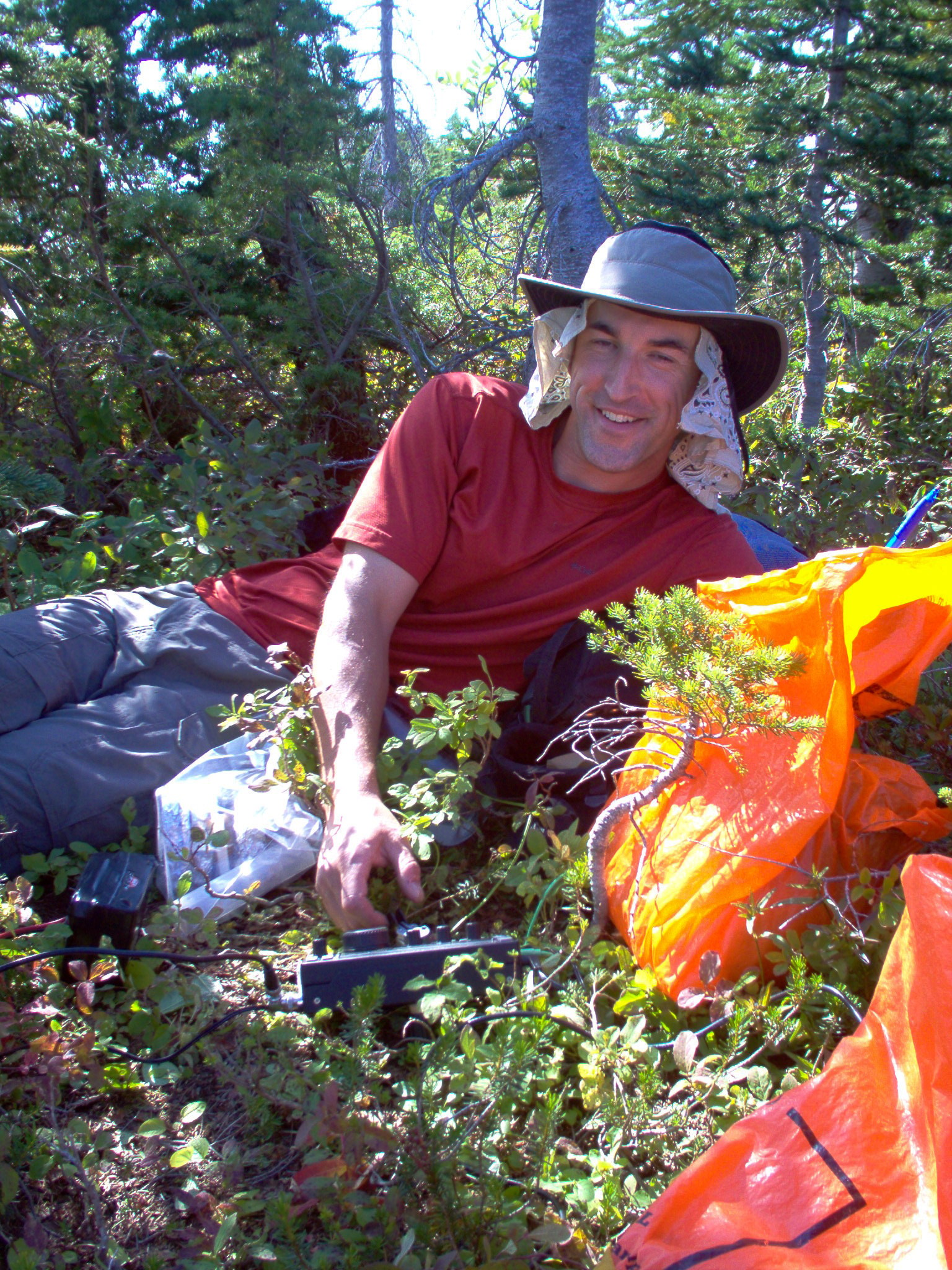
We erected two antennas, both belonging to Bruce: a heavy-duty 20 m l/2 dipole and a heavy-duty end-fed wire antenna loaded through a 9:1 unun [xiv] device. We decided to trade rigs. Bruce operated Todd's 3-band KD1JV Mountain Topper CW transceiver [xv] with his American Morse Equipment Porta Paddle-II [xvi] on the 20 m band through the dipole, powered by Todd's diminutive 3-cell Turnigy Lithium Phosphate (Li-Po) 1000 mA:h 11.1 V battery, weighing a measly 85 g (3.0 ounces).
Todd used Bruce's Elecraft KX3 transceiver [xvii] with a Begali Adventure paddle [xviii] through the end-fed antenna, which the KX3 can load on all Amateur Radio bands from 40 m through 6 m utilizing the internal tuner. He powered it through his own Shorai LFX09A2-BS12 Lithium-Iron Powersports battery, weighing 632 g (22.3 ounces).
We were both operating with about 5 W output. Our antennas were rather close to one another. Although we were operating on non-harmonically-related bands, Bruce experienced some receiver front-end overload problems from the KX3, compounding the QRM from his 20 m pileup. Todd also noticed similar problems, which he was able to ameliorate using the noise blanker in the KX3. The dit side of the Porta Paddle II gave Bruce some problems with not making contact without forceful paddling. The paddle probably needed some contact-cleaner work. Todd sang the praises of the Begali Adventure, and he made noises about trying to fit an Adventure paddle into the family budget. At €248 for the Adventure and €28 for the KX3 adapter including shipping from Italy, that paddle which Todd pronounced buttery-smooth isn't a trivial purchase. We both topped the 4-contact activation threshold in short order.
Here is the log for Todd Thompsen W7TAO:
Date
Time
MHz
Mode
Call Sign
Sent
Rcvd
Notes
2014-09-16
1944
10.118
CW
NA6MG
559
539
Dan – CA
2014-09-16
1947
10.118
CW
KB7HH
339
529
John – AZ
2014-09-16
1948
10.118
CW
NS7P
579
559
Phil – OR
2014-09-16
1950
10.118
CW
W7ALW
599
339
Barrie - MT
2014-09-16
1951
10.118
CW
N9KW
439
449
John - NM
2014-09-16
2014
146.52
FM
VA7ZZT
-
-
Alder Grove, BC - 31 miles simplex
2014-09-16
2033
24.096
CW
N6ZI
429
549
Alan - CA
Here is the log for Bruce Prior N7RR:
Date
Time
MHz
Mode
Call Sign
Sent [xix]
Rcvd
Notes
2014-09-16
1944
14.060
CW
CQ
2014-09-16
1950
14.060
CW
WØERI
P4
579
Martha Leavenworth KS [xx]
2014-09-16
1952
14.060
CW
W7RV
84
579
Thomas Scottsdale AZ
2014-09-16
1954
14.060
CW
AE5B
G3
559
John Cisco TX
2014-09-16
1956
14.060
CW
N7CW
P5
559
Bud Prescott AZ
2014-09-16
1957
14.060
CW
N7UN
G4
339
Guy Newfoundland NJ
2014-09-16
2000
14.060
CW
WA2USA
95
579
Dennis Newburgh IN
2014-09-16
2001
14.060
CW
W6UB
G3
579
Larry Friendsville TN
2014-09-16
2002
14.060
CW
K6EL
G2
569
Elliott San Francisco CA
2014-09-16
2005
14.060
CW
WØMNA
P5
599
Gary Leavenworth KS QSLed RST 599 [xxi]
2014-09-16
2006
14.060
CW
NE4TN
G4
559
Walt Mt Carmel TN
2014-09-16
2008
14.060
CW
W7DOW
G5
559
David Wilkeson WA [xxii]
2014-09-16
2009
14.060
CW
WB5USB
P6
559
George Albuquerque NM
2014-09-16
2011
14.060
CW
N9KW
G4
?
John Elmhurst IL [xxiii]
2014-09-16
2012
14.060
CW
K8LJG
P8
559
John Flint MI
2014-09-16
2014
14.060
CW
W4QO
72
339 QRM
Jim Roswell GA
2014-09-16
2017
14.060
CW
AE9F
81
339
Daniel El Granada CA
2014-09-16
2020
14.060
CW
KB7HH
G4
529
John Chino ValleyAZ
2014-09-16
2109
14.256
SSB
KC7ICV [sic]
P7
weak
net control – miscopied call sign – no QSO
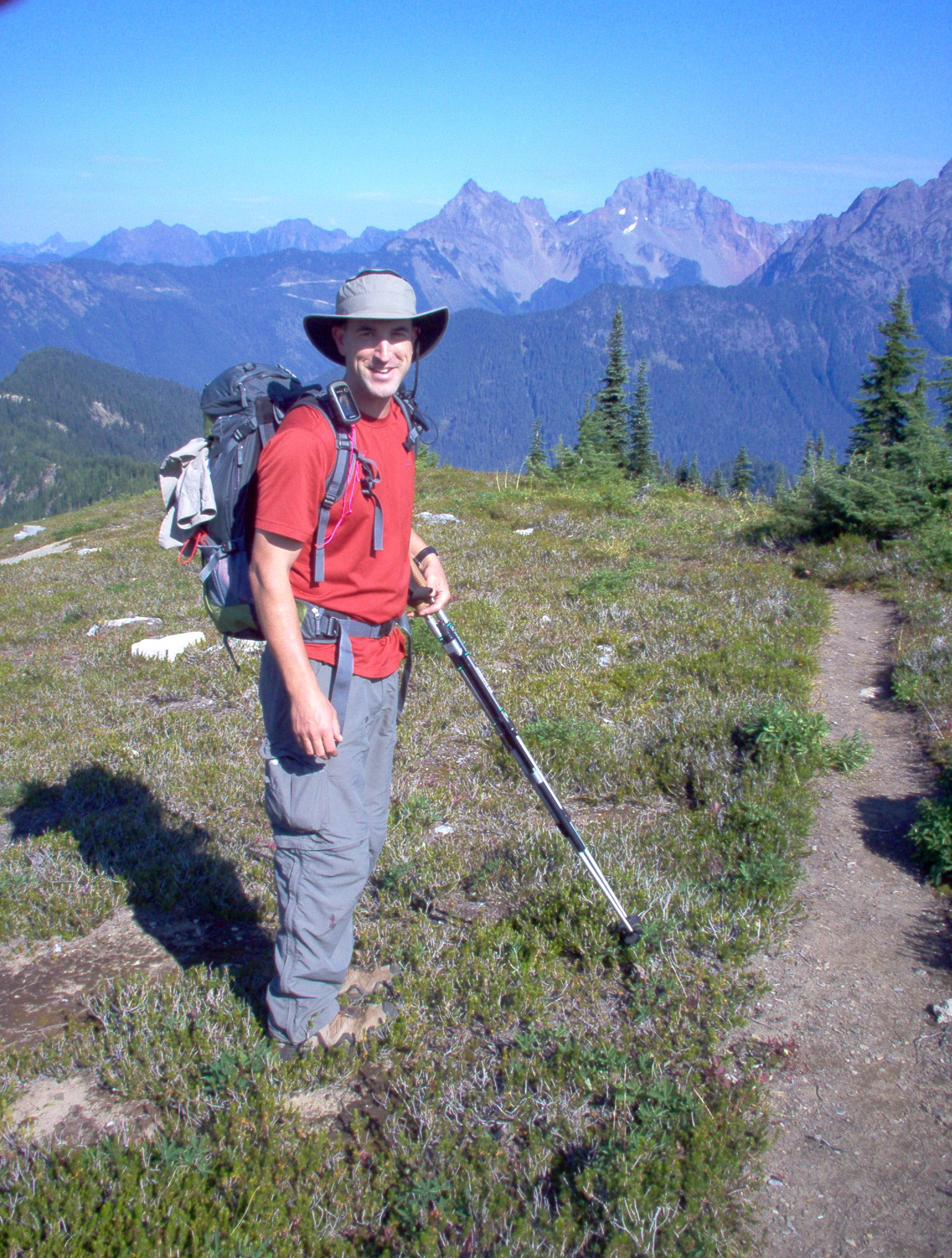
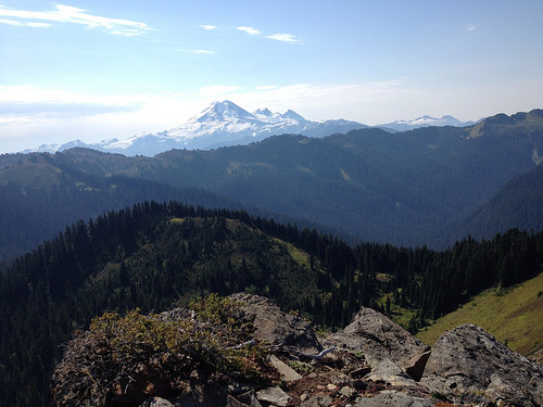
While we were packing up, Bruce said to Todd, "Look what I see!" "What's that?" Todd replied. "More SOTA summits!" Bruce exclaimed. We spent a few minutes with a map and a GPS receiver with a resident topographical map. Using azimuths from the GPS, we were able to use a magnetic compass to identify a number of SOTA summits. It's wonderful to enjoy a never-ending outdoor quest.
Todd's pace tended to be faster than Bruce's, so Todd took advantage of the extra time to harvest some delicious blueberries and huckleberries, storing them in an empty water bottle to share with his family. A few days later Bruce returned to the mountain with his wife Margaret K7MWP, taking along a similar water bottle to do the same thing.
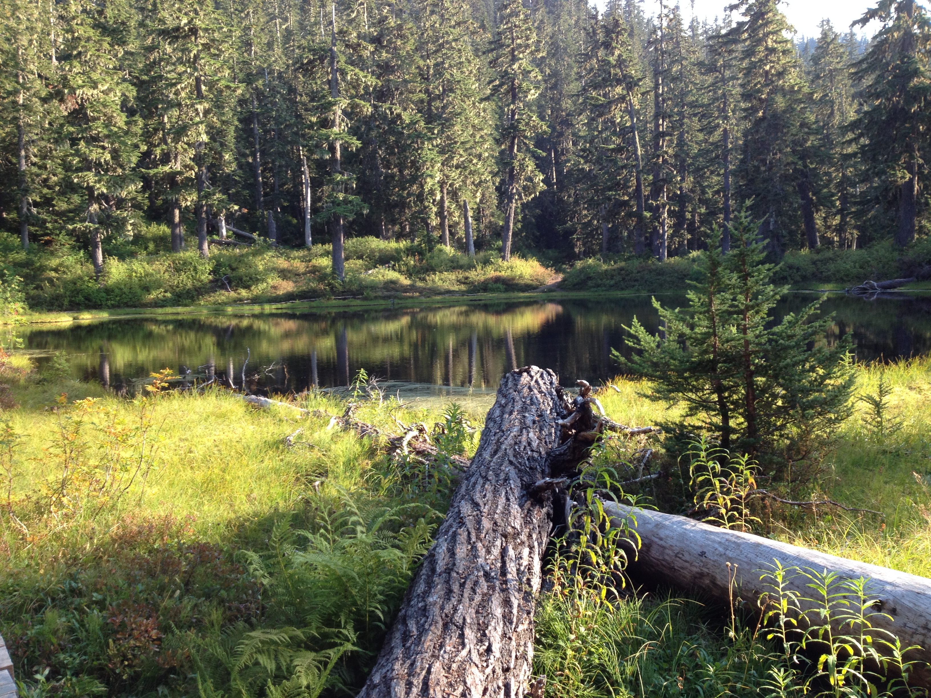
This time on the way down we took the northeast ridge trail to its junction with Boundary Way Trail 688.[xxiv] We also visited Damfino Lakes with its seldom-used campsite.[xxv]
When we looked at the same trail register which we had used, it showed a number of other parties had followed us, but they were headed for destinations like Excelsior Pass and the High Divide Trail. The only other people we saw all day were two hikers who reached the parking lot shortly after we did.
[i] N 48.9698° W 121.8006° (WGS84) elevation 1725 m (5658 feet). All coordinates in this report use the WGS84 datum.
[ii] The FS 34 junction with Mt Baker Highway SR 542 is at N 48.90467° W 121.91103°, elevation
329 m (1079 feet).
[iii] The Trail 630 trailhead on SR 542 is at elevation 558 m (1830 feet) N 48.90952° W 121.80141°.
[iv] The trail crests a ridge near Excelsior Pass at 1640 m (5380 feet) N 48.93540° W 121.79430°.
[v] The Damfino Lakes Trail south junction is at 1630 m (5350 feet) N 48.93521 W 121.79433°.
[vi] The Boundary Way Trail 688 junction with the Canyon Ridge Trail 689 is at 1437 m (4715 feet)
N 48.96032° W 121.79797°.
[vii] The Canyon Ridge Trail 689 east junction with the Damfino Lakes Trail 625 is at 1374 m (4508 feet) N48.95629° W 121.79625°
[viii] http://www.sota.org.uk/
[ix] The Damfino Lakes Trail northwest trailhead is at 1298 m (4260 feet) N 48.95920° W 121.80735°.
[x] A useful map of the area is the 1: 63 360 topographical Green Trails Maps™ Mount Baker Wilderness Climbing Map 13S.
[xi] The planned turnoff was at 1609 m (5280 feet) N 48.97235° W 121.79216°.
[xii] We left upslope from the trail at 1588 m (5210 feet) N 48.97005° W 121.79608°.
[xiii] https://www.youtube.com/watch?v=b_VU4KOBn5A
[xiv] The unun is an unbalanced-to-unbalanced impedance transformer.
[xv] http://g0bpu.blogspot.com/2012/05/mountain-topper-radio.html
[xvi] http://www.americanmorse.com/portapaddle.htm
[xvii] http://www.elecraft.com/KX3/kx3.htm
[xviii] http://www.i2rtf.com/html/adventure.html
[xix] N7RR gave signal reports according to the Copyability & Strength system, which is summarized at http://www.qrz.com/db/n7rr and explained in more detail at http://www.lra.se/bilagor/N7RR.pdf .
[xx] YL of WØMNA
[xxi] OM of WØERI
[xxii] This contact required unusual 20 m propagation. That short distance is normally in the skip zone between ground wave and ionospheric propagation.
[xxiii] Bruce lived in Elmhurst IL as a toddler!
[xxiv] The junction is at 1620 m (5315 feet) N 48.97158° W 121.79428°.
[xxv] The Damfino Lakes campsite is at 1366 m (4482 (feet) N 48.95473° W 121.79365°.