The route to Gobblers Knob looked difficult on the maps. I collected paper maps and laid out several GPS tracks. I started my approach from the little town of Yamhill and within the first 10 miles had already hit my first locked gate. Then another. Then another. As the rain pelted the windshield, the thought of bailing on the adventure crossed my mind. But then the crazy-side regained control. I decided to go with intuition rather than maps. After more than an hour and a half of slowly working my way through the tangle of logging roads, I hit the final drive up to the summit. A four wheel drive isn’t necessary, but having a little extra clearance and good tires isn’t a bad idea for some of the areas where the log trucks have worked the roads over pretty well.
At this point I’ll just be up front, I’m not going to give directions. It is highly likely that by the time you go, the route would be different as I drove through a number of gates that were signed as being opened specifically for elk season. That said, I’ll give a little hint later as to a better route.
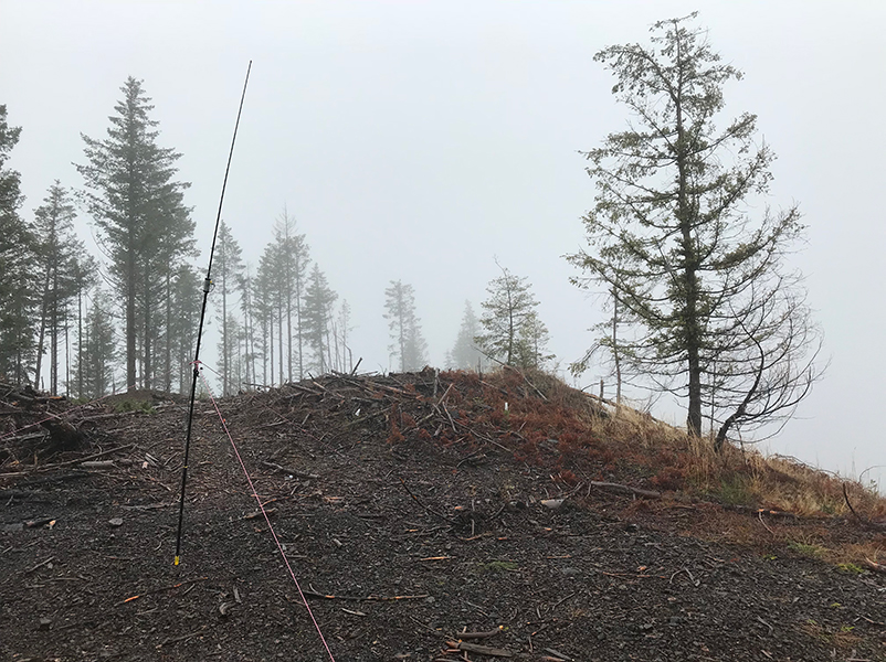
This can be considered a drive up as you can literally drive to the summit plateau, the point of an old fire lookout. The summit area now sits on the edge of a huge clearcut that was created in 2015. That said, driving here is borderline nutty. Only an obsessive peak-bagger would make the journey, or one that is hellbent on playing out a childish Thanksgiving play-on-words.
My guess that the winds on the summit were consistently 30 mph with the occasional gust well over that. But that paled in comparison to the near biblical rainfall. I expected it would be nasty and planned for it by bringing a mountaineering tent. I sat in the car and assembled as much of the tent as possible while the wind and rain rocked us to and fro. With a burst I jumped out, ran up to the summit area and quickly staked it down. Back at the car, I repeated the exercise with the assembly of the antenna. After the sprint out through the storm was complete and the antenna was up, I hustled the radio gear into the tent and ran the feedline through a small unzipped opening in the door. This would be my hamshack.
I once again found myself having SMS and APRS spotting issues. After calling for five minutes or so on 20m, I was picked up by a gentleman in Texas who then spotted me on DXwatch. Holy crap - all hell broke loose as everyone that was sitting around waiting for Thankgiving dinner to be served suddenly was calling me. In the middle of working the increasingly growing pileup, the antenna blew over. Out into the gale I went to get it staked back up. This played out a couple of times.
After 45 minutes, the rain I had tracked in combined with the water that had run down the feedline was starting to make a noticeable and worrisome puddle in the tent. I apologized profusely to those still sitting in the pileup, wished everyone a happy Thanksgiving, and shut it down. I had logged 37 contacts including two Summit-to-Summits and a gentleman in Wales.
I tore everything down and hefted the soaking gear into the back of the Jeep. Rather than take the original route, I opted to follow advice my dad had given me about getting out of the woods – go downhill, follow the base of the forks in the road, and rivers eventually lead to civilization. In 30 minutes I was sitting just outside of Tillamook. My recommendation to anyone wanting to do this in the future - follow the North Fork of the Trask river up. It is way easier.
Oh, and Happy Thanksgiving from Gobblers Knob, Oregon.