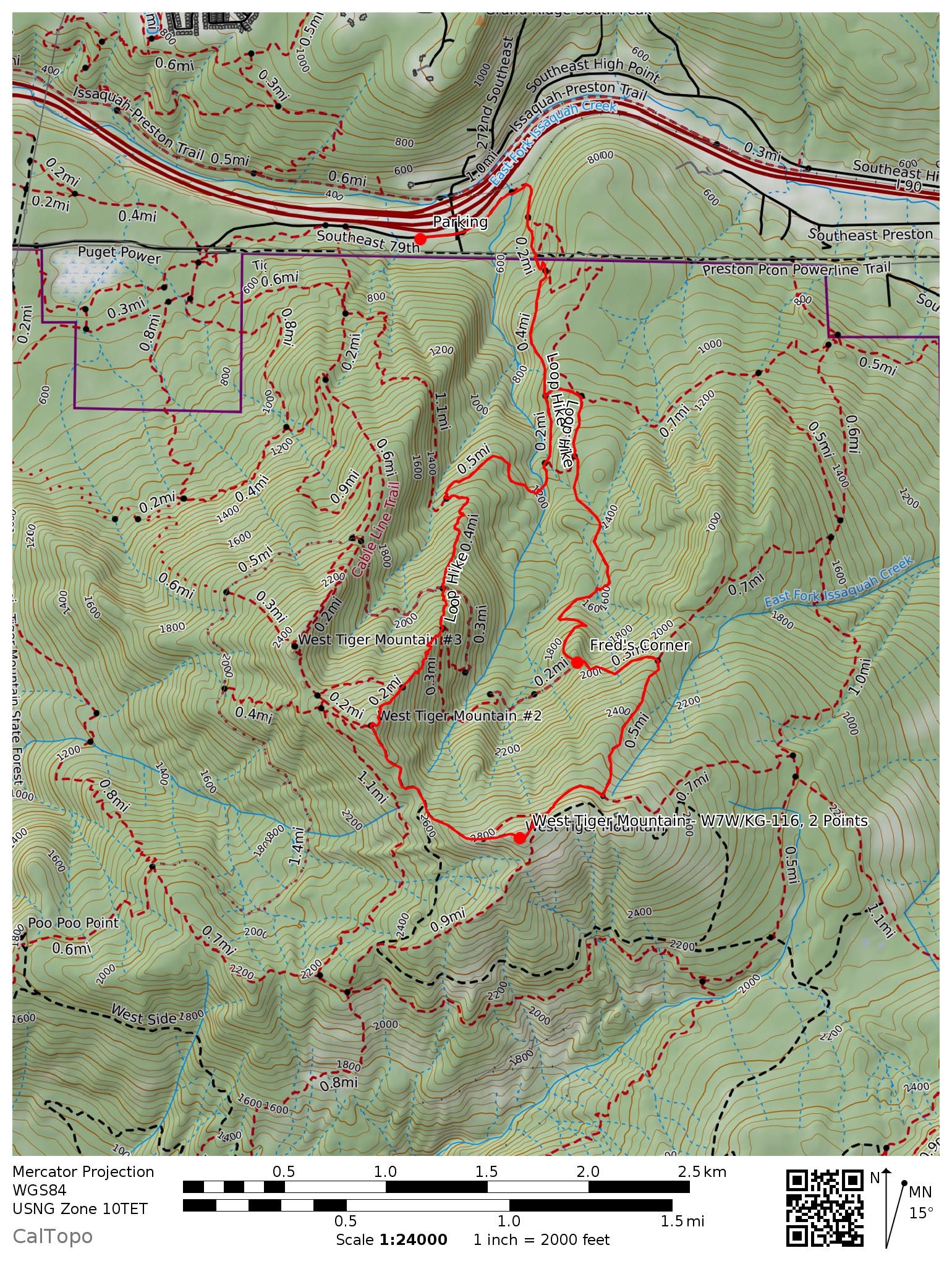
West Tiger Mountain is one of W7W's most frequently activated summits. It is part of the 'Issaquah Alps', and being close to Seattle is a very popular day hiking area. Arrive early to get parking near the trailhead, and don't forget your Discover Pass!
There are a series of summits called 'West Tiger' - the one we are interested in for SOTA is known as West Tiger 1.
I recently signed up for the Seattle Mountaineers Alpine Scramble course. Part of the class is to go on some conditioning hikes. Naturally I selected a hike to a SOTA summit! I met up at 8am Saturday morning with the trip leaders and some other scramble students - 11 people total in our group.
Our route was a counter-clockwise loop over West Tiger 2 and West Tiger 1, using the K-3 trail on the way up, and descending via the Preston Junction and Fred's Corner. Total mileage was about 8 mi with 2900' of elevation gain. The hike was mostly on compact snow / ice and we wore microspikes for ~90% of the hike.
The weather was clear and sunny with good views at the summit. There is still a ton of snow left over from the big snow storms we had recently. I was able to get in a quick 2m activation while the others ate lunch. It was a struggle! There is SO MUCH RF in this area, my poor Yaesu H/T was getting blown away. I walked back down the road toward West Tiger 2 a bit, and was able to find a position that allowed me to hear some of the stations that were trying to call me. By the time I had made 6 contacts I noticed the group was packing up. Time to go!
In summary, West Tiger 1 is a fun / moderate hike that is close to Seattle. Be prepared to deal with high levels of RF on the summit - make sure you know how to turn on your rig's attenuator if it has one. A directional antenna would likely help. For more info on this summit, see K7ATN's report from 2012.

