Getting there
From Seattle: Take Highway 2 east to Wenatchee, go north on 97 to Tonasket. Go east on Highway 20 to Republic and then head north on Highway 21 until you hit Malo, WA.
From Spokane: (I haven’t done this, but it looks legit from the maps) Take 395 North to Kettle Falls. Take highway 20 west to Republic then head north on Highway 21 until you hit Malo, WA.
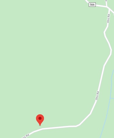
Once you’re in Malo (from either direction) turn off on 566 or Aeneas Creek Road (Green arrow in image) Follow on Aeneas Creek road for about 4 miles. You’ll get to the red arrow (see image), there will be a fork in the road. This is where you’ll want to park your rig. There isn’t really a place to park, so pull yourself off the road onto the edge. If you passed a large empty wood sign holder, you’ve gone too far.

Parking: Otis road looks like you could drive up it however; there is ZERO places to pull out and park once you get up the “road” a bit. Also I notice various nasty objects in the ground (metal rods, broken glass, etc) so you might get it in there, but your tires may not come out in one piece.
I don’t believe a pass is required as I doubt you’ll come across anyone. However, it is National Forest land.
Date/Season of Year: Memorial Day weekend 2020
Vehicle Support: You certainly could use a sedan to get up to Otis road however it’s not a maintained road so YRMV depending on time of year.
Cellular Support: Outside of AT&T, there is zero cellular access out there. AT&T is even spotty, so don’t plan to use data/voice while you’re up here.
The Hike:
Hike up the road up for about a 1 mile. You will look to the right you will notice an old WA state license plate laying on the ground (this is where you will want to start heading up). If you look at the map and you look at the road, you will be just past the summit reference point on the map where you’ll head off the trail. You will notice there is a bit of a path there, but you will be mostly bushwhacking your way to the top. (see map below)

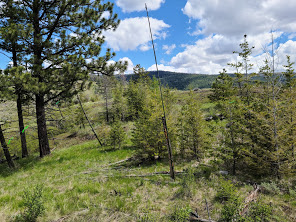
From here I just followed the least path of resistance as I made my way north up the slope. Once I got towards the top, I found a small grove of trees just off the summit spot (but still within the proper elevation)
In the trees (see image below) I tethered my Jackite mast to it and then strung my Packtenna 20m Dipole up and tied it off to a couple trees in an inverted V setup. With my FT-891 on 20m I was able to reach out to the east coast with relative audio clarity. I appreciate everyone who helped me with this first HF SOTA activation!
