Hungry Mtn is located in the Okanogan National Forest near Carlton, WA. It’s only a short distance from the highway, with a short steep climb from the end of the road. No water, no trailhead, no facilities, no permits. You’ll likely want to use a high-clearance, 4WD vehicle – this road will be soft and slippery when wet. This peak took me about an hour to walk in to, and half that time to get back to the truck.
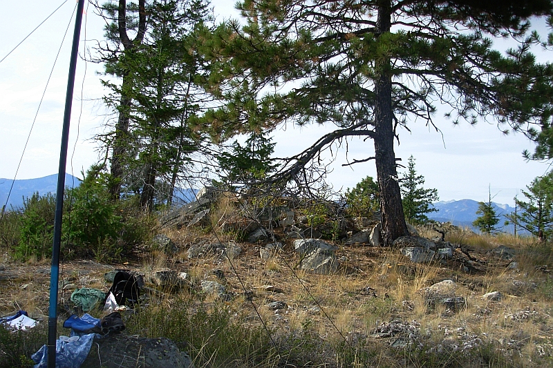
From where I parked, it was a short distance to the end of the road where I turned NNE for the top of the ridge. From there it is straightforward to reach the summit to the north. There’s no blazed trail, but there are some branches marked with orange tape showing the way up that you can follow – they’d be very handy at night. I traveled a bit left of the marked route.The forest isn’t dense and route-finding is easy.
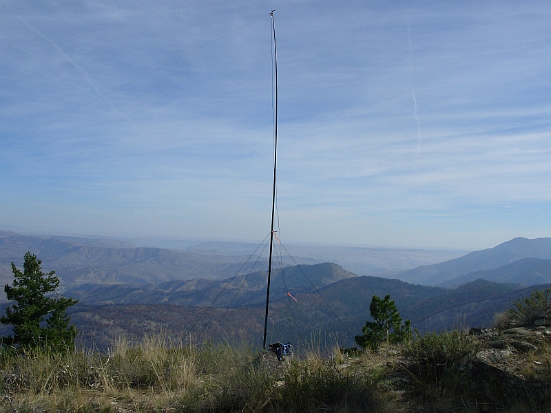
The summit is a large area and is mostly open - with enough trees for some shade or to hang a wire from. I planted the base of my telescoping pole in some rocks and easily guyed it down - orienting the linked inverted-V to the SE. Propagation on 20M was good, and N4EX was kind enough to spot me right away on the Sotawatch site – Thanks Rich! Within ½ hour I had 23 contacts logged – including 2 DX stations and one S2S.
One problem I had was that when DK1AX called, I kept asking him to repeat since I didn't expect the DX callsign and kept trying to get a U.S. prefix from him. Sorry about that Klaus!
I enjoyed a nice sunny day on this trip. The dry air on this side of the Cascades is staying cool now in October, and I had to remind myself to drink water since I didn't get very thirsty. All-in-all, a very uncomplicated activation that we'll do again next year.
Directions:
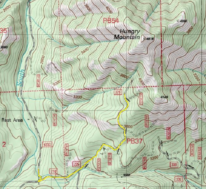
Get here from Hwy 153 about 3.5 miles south of the town of Carlton. Take the Gold Creek Loop Road for about 1.5 miles and then turn west on the Gold Creek Road.
Continue another mile on the Gold Creek Rd and then turn left onto the South Fork Gold Creek Road - (aka National Forest Road 4330).
Drive up the very nice NFR-4330 about 5.3 miles and take the sharp left turn onto NFR -200 (also signed as the turn for McFarland Creek). Note that my topo map showed this as road # 210, and Google maps displays # 225 - but the nice new sign reads as # 200.
Go only about 1/3 mile and at a sharp right-had curve, bear left and head up. This last road is steep and a bit rough - but there are no more turns. I drove as far in as I could, and then backed down to where I could turn around. That wide spot was at 3,665’ and about .9 from NFR-200. I recommend parking there and not at the end.