Silver Star is a classic hike in SW Washington that should be on everyone's list to do at least once. There are two approaches to this summit - from the north via Battle Ground, WA, described here: https://www.oregonhikers.org/field_guide/Silver_Star_Mountain_Trailhead, and also from the south via Washougal, WA, described in this trip report.
The hike from the north is shorter and more pleasant, however the drive is longer and very rough, challenging perhaps for some high clearance vehicles. The hike from the south is much rougher, with several long sections of large loose rocks, but it does have a shorter and easier drive that can be easily done in a passenger vehicle. This southern approach is decribed below.
Of particular note is that the remote southern Grouse Vista Trailhead described here requires a WASHINGTON DISCOVER PASS and that enforcement can occur on weekdays, off season, or otherwise when you wouldn't expect authorities would bother (the citation is $100). The norhern trailhead in the link above requires a NORTHWEST FOREST PASS.
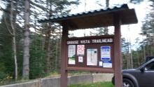
Drive State Route 14 east of Vancouver to Exit 16 for Washougal, Washington. Turn left and go through the small town and then continue north and east on Washougal River Road (SR 140). About 6.9 miles from the freeway, turn left at a sign for Bear Prairie. Drive 3.2 miles, then turn left on Skamania Mines Road. Drive north for 2.7 miles, then turn left on gravel road 1200. Follow signs, staying left at one point, to arrive at Grouse Vista Trailhead after 5.7 miles. The tralhead is near 45.7219° -122.2695° and the last seven miles are on well-graded gravel.
Note that there are trails heading both east and west from the Grouse Vista Trailhead - another nearby summit is W7W/LC-103 - Larch Mountain that can be accessed by heading up the west trail. The Silver Star trail is to the east or across the road from the parking area.
The Silver Star trail is about 6 miles RT and 2000 feet of gain. There are several branches - a map is always a good idea, (http://www.fs.usda.gov/Internet/FSE_MEDIA/stelprdb5160926.pdf) but in general, keep left at the first intersection and stay on the main track until you arrive at a large rock carin where you'll go right up the rough road-width trail the final quarter mile to the summit.
On busy summer days you should expect lots of hikers up here - there are only a few areas to comfortably operate near the summit where there are small trees for supporting antenna poles near the summit proper.
Once you are all the way to Silver Star, you might consider adding another four steep miles to your Silver Star hike by activating nearby W7W/LC-085 - Peak 3977 (to be called "Starway" when the W7W ARM is fully updated). See http://www.pnwsota.org/blog/k7atn/2012-september-16/peak-3977-wa-discriminator-pk-sep-2012.


