8/17/23 Update - Not really a recommended summit due to new "Preferred Plan" with "sensitive" areas of park, along with varying topo maps regarding whether park is in the AZ... Please note a "Preferred Plan" for Lord Hill Park was presented in Summer 2022 (links on park website below), which laid out a "sensitive" area in the SE area of park near the summit. Unsure specific use rule regarding this planned sensitive area, and am interested to learn more as this preferred plan is estimated to be completed over the next 10 years due to magnitude and list of projects. Regarding the summit AZ being within the park, it is in the park via the sotl.as map...but not in the AZ in other topo maps. With variation in topo maps, would love to get clarity "on the ground" validation of GPS elevation within the park (likely tough to do,)...but am uncertain about new sensitive area use rules.
______________
Bald Hill is located just west of Monroe in Snohomish County, WA. While the summit is on private property, there is a small activation zone located in the SE corner of Lord Hill Regional Park. Hiking distance was ~2.2miles RT, and 467 feet of gain (most of which was in short section of Pipeline trail).
To access, park in the South Parking lot (see map link below), and head North on the Entrance Road which turns into Pipeline Trail. After heading up the steep section of Pipeline trail (you can go on Tuck's trail for more gradual path), head East on Loren's Ridge. At the end of Loren's Ridge trail, you will start to go off-trail heading Southeast. (The trail map shows a gray trail heading toward the activation zone, but I didn't see a trail). In March 2019, the off-trail section was relatively short and easily accessible. It may be more difficult in summer with increased vegetation?
Below are links to the Lord Hill website, and specific link to the trail map.
https://snohomishcountywa.gov/Facilities/Facility/Details/Lord-Hill-Regional-Park-35
https://snohomishcountywa.gov/DocumentCenter/View/63318/Lord-Hill-Trail-Map?bidId=
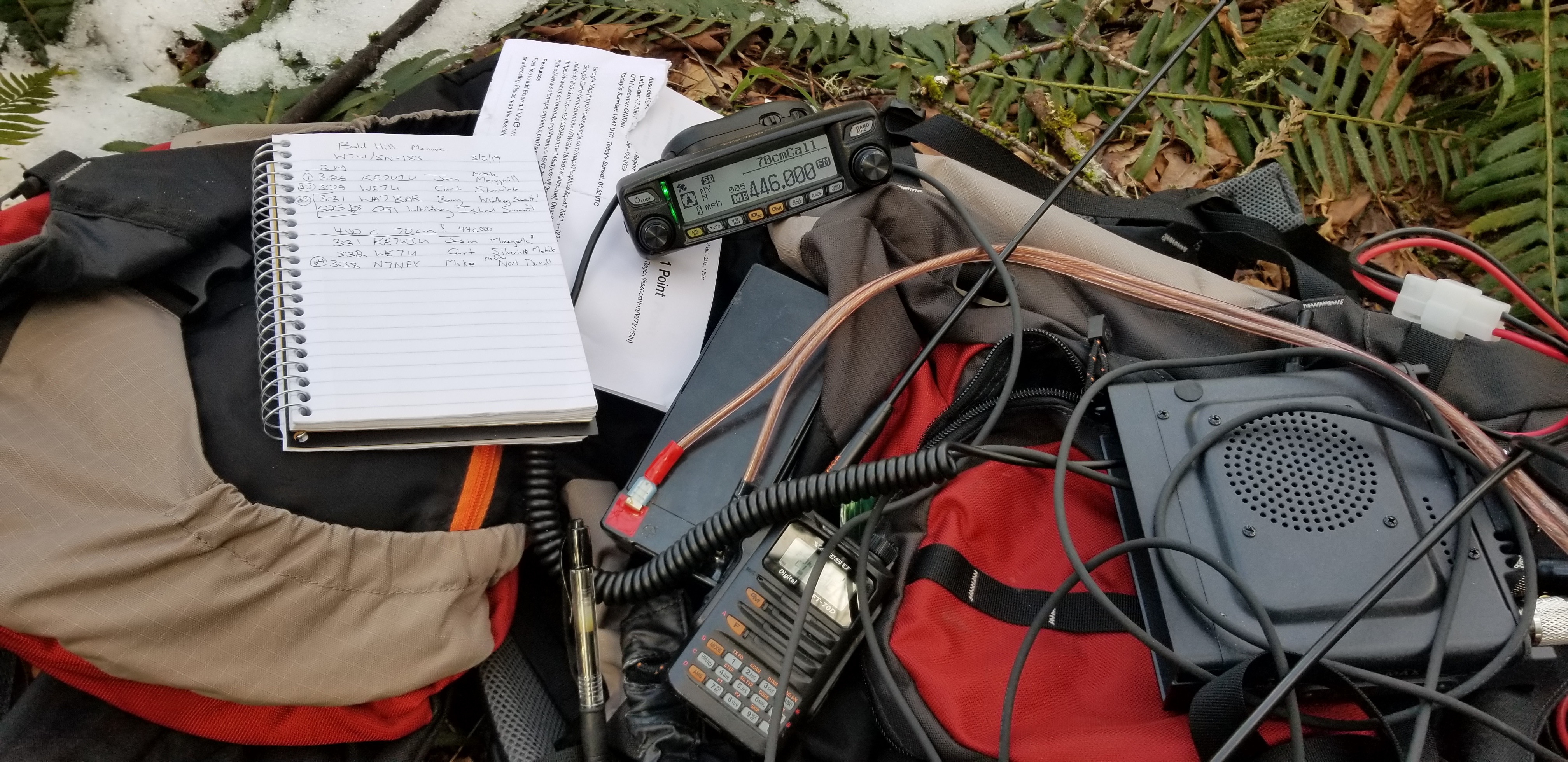
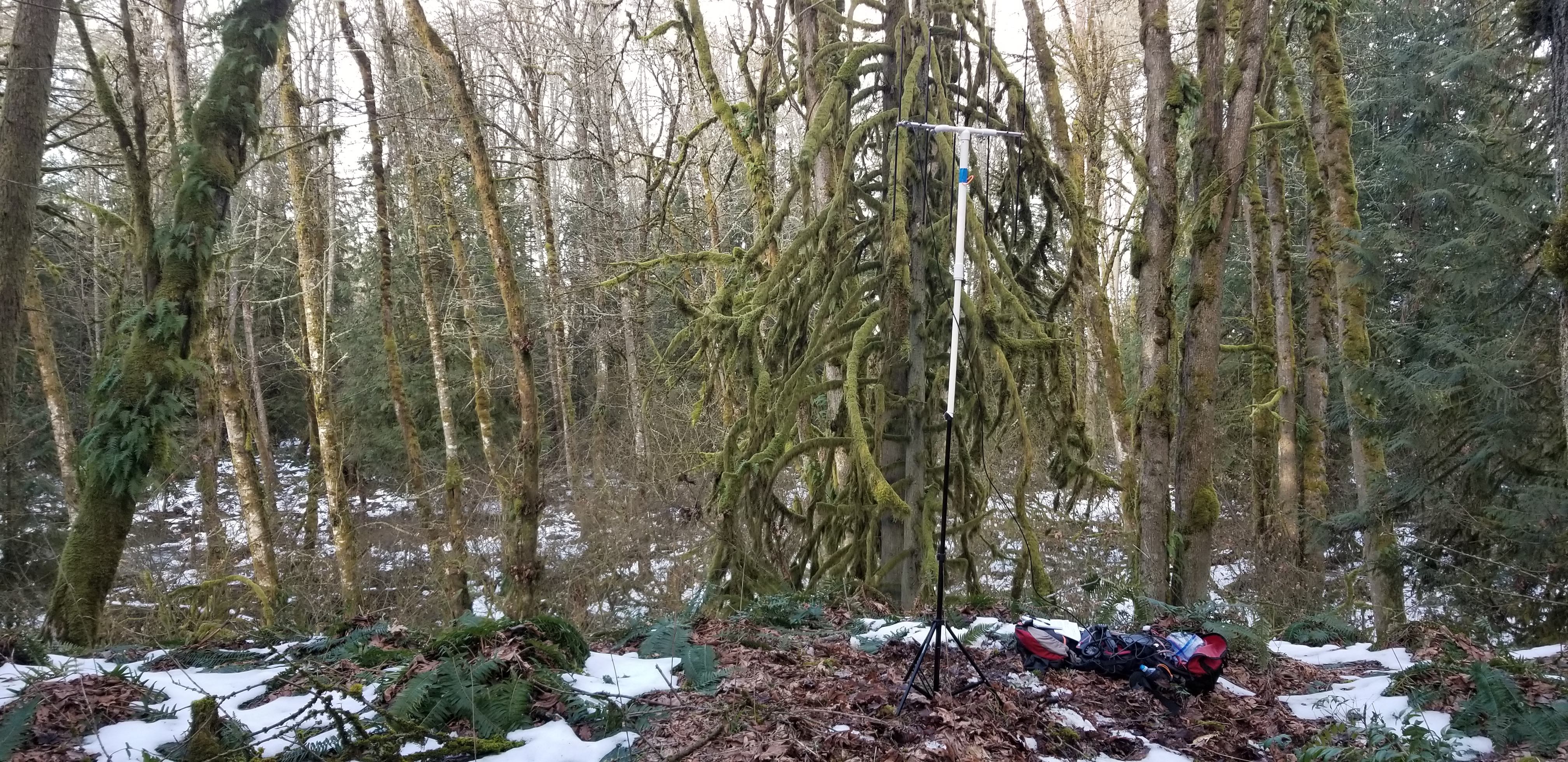
The activation area is forested with no views. My first summit attempt with 5W HT and rollup Jpole was unsuccesful, and went overkill the second time with 50w mobile (Shorter hike and I didn't want to attempt again) (-:
Pictures below show:
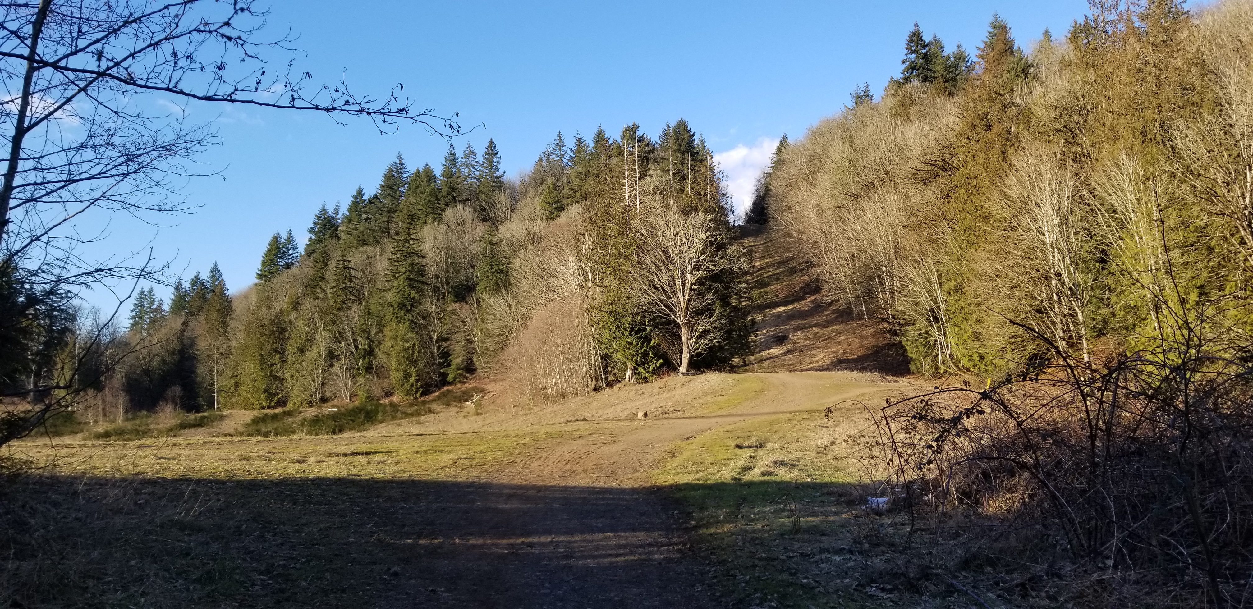
1) Early in hike, looking up steep section of Pipeline Trail
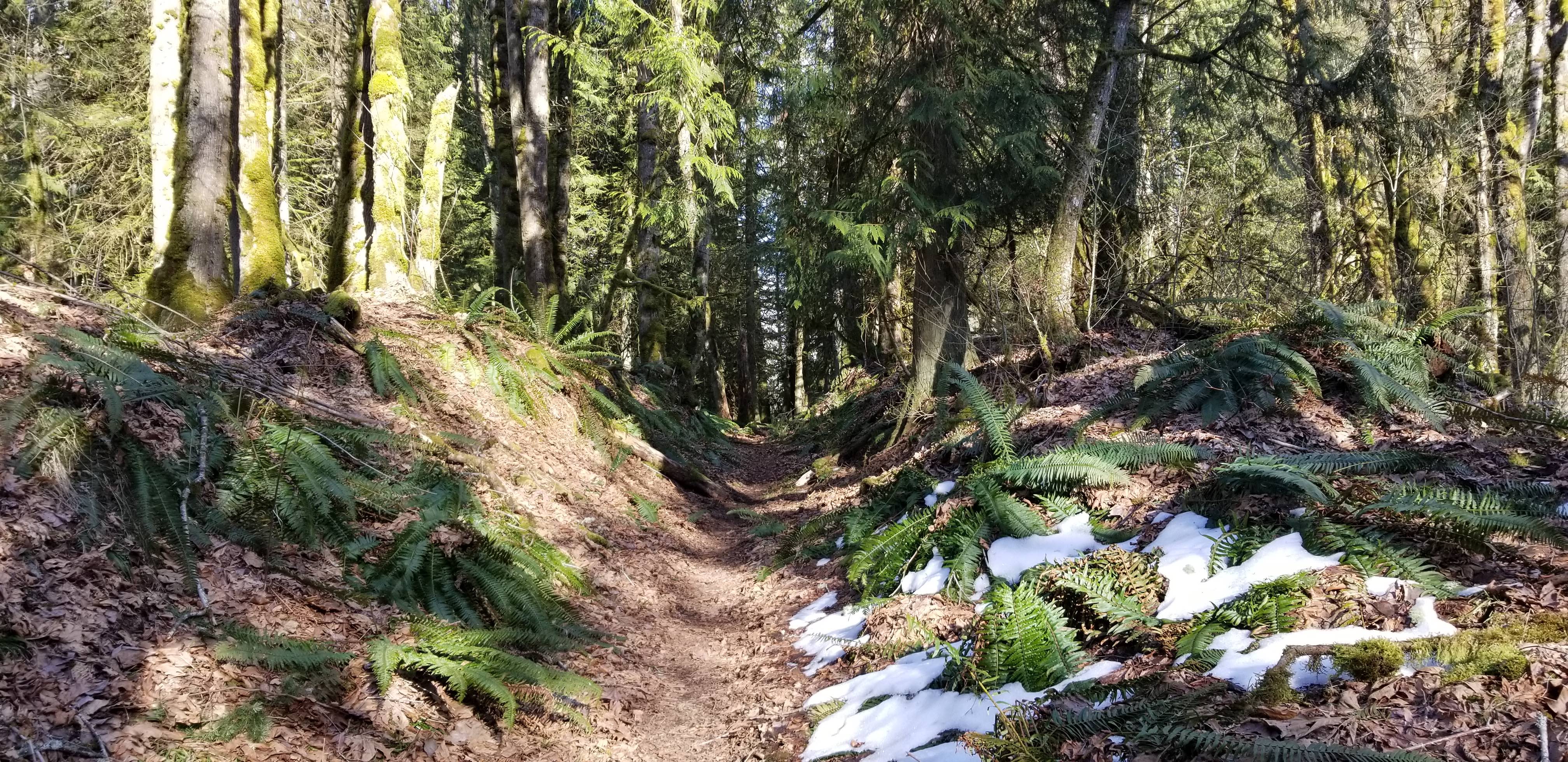
2) Hiking on Loren's Ridge
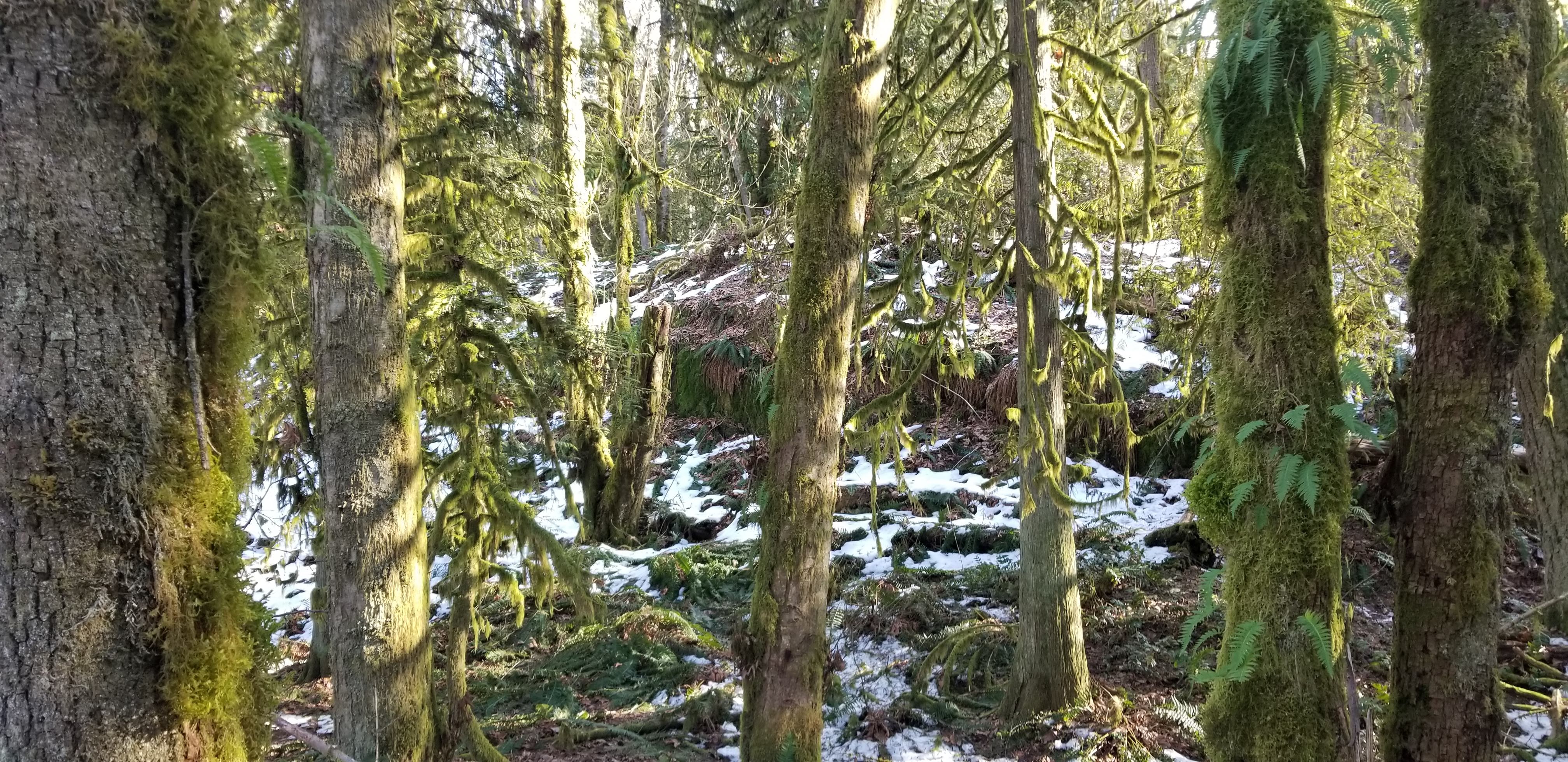
3) Hiking off-trail, and looking at higher "shelf" area where finally activated
4) Radio setup, so far only time used 50w mobile for activation! (-:
5) Activation area with radios and antenna